

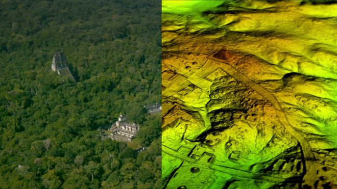
"Lidar is revolutionising archaeology the way the Hubble Space Telescope revolutionised astronomy," Francisco Estrada-Belli, a Tulane University archaeologist, told National Geographic.
BELOW GUATEMALAN JUNGLE
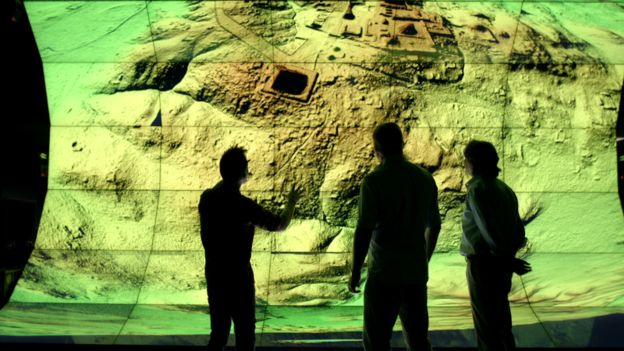
under Guatemala jungle
How Does Lidar Work? This NEON Science video overviews what lidar or light detection and ranging is, how it works and what types of information it can provide. The video was produced by the National Ecological Observatory Network - a non profit project devoted to open science and open data:
Meanwhile in Cambodia...

And in the UK: Archaeologists have discovered more than 3,000 historical sites and monuments in the New Forest thanks to Lidar (Light Detecting and Ranging). The technique beams harmless lasers into the ground to build a 3D map, revealing the hidden history of the New Forest including a Roman road:
This short film shows the landscape around Stonehenge as recorded by LIDAR survey (airborne 3D scanning). Millions of measurements were taken across the landscape, and here they have been turned into a 'solid' computer model to show how well the archaeology is recorded by this method:
A website set up by the US Geological Survey and intended to "facilitate data access, user coordination and education of lidar remote sensing for scientific needs":


No comments:
Post a Comment