Wednesday, February 21, 2018

Ancient DNA shaking up our knowledge of the past

The use of DNA analysis is overturning a lot of cherished ideas dug up by archeologists...


Excellent summary of ancient DNA research:

Ancient DNA: the first three decades


Genes of ‘extinct’ Caribbean islanders found in living people

Jorge Estevez and other members of the Higuayagua Taino community dance at a festival in New York City. Taino groups have fought against the idea that indigenous Caribbean islanders died out after European contact.

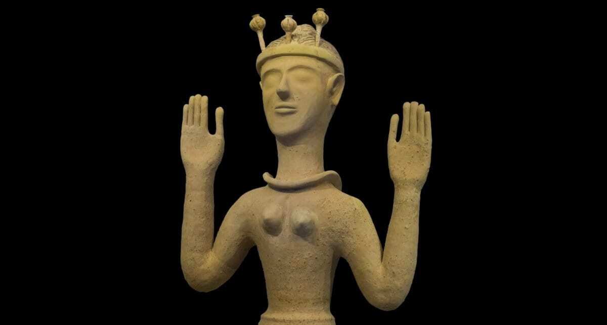
Ancient DNA analysis reveals Minoan and Mycenaean origins


On islands in the Gulf of Alaska, ground squirrels are not a recent, human-mediated introduction (as previously thought) and may have colonized via a natural dispersal event or an ancient human translocation:

 Integrating archaeology and ancient DNA analysis to address invasive species colonization in the Gulf of Alaska

Evidence of human use of ground squirrels on Chirikof Island, Alaska: (a) parka created by Susan Malutin, Grace Harrod, and community volunteers for the Alutiiq Museum in 1999, with support from the Alaska State Museum grant-in-aid program (catalog number AM405; photo by Marnie Leist); (b) skeletal elements showing cut marks across the occipital condyle of the cranium; and (c) burning and calcification seen on a proximal femur, distal humerus, and proximal ulna.


Tuesday, February 20, 2018

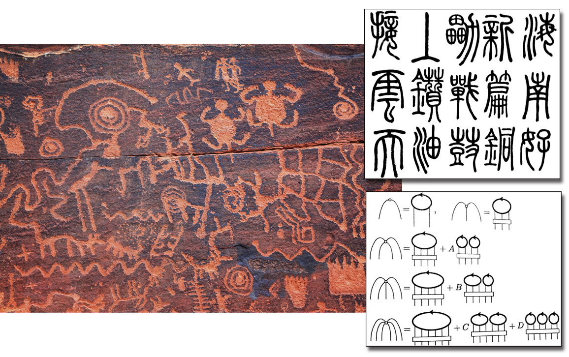
Quon: New Mathematical Picture Language

From the time of Euclid, pictures have been an important part of mathematics.  We get a better understanding of complex numbers and their mind-bending equations by picturing them in terms of vectors and graphs:


Non-Euclidean Geometry is best explained in terms of Euclidean models:


"A picture is worth 1,000 symbols,” quips Professor Arthur Jaffe. Jaffe and postdoctoral fellow Zhengwei Liu have developed a pictorial mathematical language that can convey pages of algebraic equations in a single 3-D drawing:

Harvard Gazette: Picture-perfect approach to science 

Pictorial laws appear to unify ideas from disparate, interdisciplinary fields of knowledge, linking them beautifully like elements of a da Vinci painting. The group is working to expand the pictorial mathematical language first outlined last year by Arthur Jaffe, the Landon T. Clay Professor of Mathematics and Theoretical Science, and postdoctoral fellow Zhengwei Liu:


Here is the ground breaking paper by Arthur Jaffe, the Landon T. Clay Professor of Mathematics and Theoretical Science, and postdoctoral fellow Zhengwei Liu:


Wednesday, February 14, 2018

Index of Past Posts Arranged by Subject Area


Here is an expanded index of past posts. We are always revisiting and revising these posts, seeking to add more information on each subject:

Posts Sorted by Subject


Amphibians
Apes
Apes, Music
Archaeology and DNA
Archaeology and Lasers
Archaeology and Astronomy
Astronomy
Astronomy
Astronomy
Astronomy
Astronomy
Astronomy
Astronomy
Astronomy
Astronomy
Biology, Mathematics
Birds
Birds
Birds
Birds
Birds
Birds
Birds
Birds
Birds
Brain
Brain
Brain
Brain
Brain
Computers
Earth Science
Ecology
Education
Education
Energy
Energy
Evolution
Geology
Geology
Internet
Language and Spelling
Life Sciences
Marine Life
Marine Life
Marine Life
Marine Life
Marine Life
Marine Science
Mathematics
Mathematics
Mathematics
Mathematics
Mathematics
Mathematics
Mathematics
Medical Research
Music and Inventions
Paleontology
Paleontology
Philosophy
Philosophy, Brain
Physics
Physics
Physics
Physics
Physics
Physics, Mathematics
Probability and Statistics
Reptiles
Robotics
Science in General
Space
Space
Space
Space
Space


    Friday, February 2, 2018

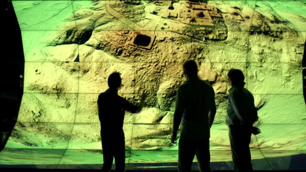
    Laser Light Imaging, Detection, And Ranging Technology or "LIDAR" Revolutionizing Archaeology


    "Lidar is revolutionising archaeology the way the Hubble Space Telescope revolutionised astronomy," Francisco Estrada-Belli, a Tulane University archaeologist, told National Geographic.

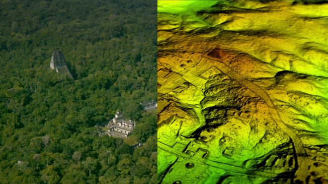
    BELOW GUATEMALAN JUNGLE 

     "Using a revolutionary technology known as LiDAR (short for 'Light Detection And Ranging'), scholars digitally removed the tree canopy from aerial images of the now-unpopulated landscape, revealing the ruins of a sprawling pre-Columbian civilization that was far more complex and interconnected than most Maya specialists had supposed."

    under Guatemala jungle 


    How Does Lidar Work?  This NEON Science video overviews what lidar or light detection and ranging is, how it works and what types of information it can provide. The video was produced by the National Ecological Observatory Network - a non profit project devoted to open science and open data:


     Meanwhile in Cambodia...


    And in the UK:  Archaeologists have discovered more than 3,000 historical sites and monuments in the New Forest thanks to Lidar (Light Detecting and Ranging). The technique beams harmless lasers into the ground to build a 3D map, revealing the hidden history of the New Forest including a Roman road: 


     This short film shows the landscape around Stonehenge as recorded by LIDAR survey (airborne 3D scanning). Millions of measurements were taken across the landscape, and here they have been turned into a 'solid' computer model to show how well the archaeology is recorded by this method:


    A website set up by the US Geological Survey and  intended to "facilitate data access, user coordination and education of lidar remote sensing for scientific needs":


    The Great Lake Huron Rock Puzzle

      As a boy, I found this chunk of limestone on the shoreline of southern Lake Huron, Canada near the town of Goderich: The rock is 23 cm (9...